
K4JLS.COM · AMATEUR RADIO
WELCOME TO K4JLS.COM
K4JLS
K4JLS
Ham Radio Operator
From Anderson, South Carolina to stations around the world. Explore amateur radio, build antennas, sharpen your Morse code and plan your next simplex contact.
JIM · K4JLSKEN · WA4JWD73 / CQ / DX
LIVE SPACE WEATHER · NOAA SWPC
On-air conditions right now
Observed data from NOAA, not a guaranteed signal prediction. Readings refresh when connected.
Planetary Kp—Loading NOAA…
10.7 cm solar flux—Solar flux units (sfu)
Solar wind—km/s
Geomagnetic—NOAA G-scale (0–5)
Waiting for live NOAA dataNOAA source ↗
ANDERSON, SOUTH CAROLINA · EM84
Explore live radio activity
♫ NEW COLLECTION · WA4JWD
Open the Music Studio →WA4JWD MIDI Files
Visit Ken's dedicated MIDI music studio: animated piano, multi-instrument mixer, sheet-music preview and playlists.
On the air
AMATEUR RADIO STATIONEM84
K4JLS • WA4JWD
HELLO DE WA4JWD AND K4JLS 73
Hear “HELLO DE WA4JWD AND K4JLS” in CW.
KEN + JIM · WA4JWD / K4JLS
WA4JWD & K4JLS Radio Workbench
Three hands-on amateur radio tools, designed for learning and planning.
🧰 Radio Toolbox — calculators & quick reference
Ohm’s law, SWR, dipoles, ground-plane antennas, HB9CV, helix, dB, wavelength, wire size, band plans, Q-codes and more.
73 from Ken & Jim
These tools run in your browser. Your Morse practice scores and logbook are saved locally to this device. The antenna planner can download a PDF directly to your computer or iPad.
MORE FROM THE SHACK
Radio resources
Repeaters, bands, propagation, tracking and local radio conditions.
K4JLS · WA4JWD & K4JLS
Radio Toolbox
Calculations and plain-English explanations. Practical reference tools for ham radio operators.
CALCULATE · LEARN · BUILD
17 toolsYour radio engineering workbench
Pick a calculator or reference. Calculations run in your browser without a paid AI account. Approximate antenna measurements are starting points; use an antenna analyzer before transmitting.
CALCULATORS
Radio toolbox
Choose a tool.
Sources: ARRL band plan · ARRL license chart (2026) · RF textbook equations. Radio equipment and location-specific restrictions always take precedence. HB9CV and helical reference geometry require engineering verification.
LOCAL REPEATER DIRECTORY
Repeaters within 50 miles
Centered on Anderson, South Carolina · 2 m, 1.25 m and 70 cm · South Carolina and nearby Georgia
50 mi default radius— matching listings
About distance: Mileage is straight-line from downtown Anderson to the listed city or approximate mountain/site location—not a surveyed tower coordinate. Some sites near the radius edge may differ. Listings are a curated snapshot, not a real-time on-air test. Confirm current tones, status and access before programming or transmitting. The “50 miles” setting is a geographic filter, not guaranteed radio coverage.
SPACE WEATHER
Propagation & solar conditions
Latest available NOAA Space Weather Prediction Center observations (internet required).
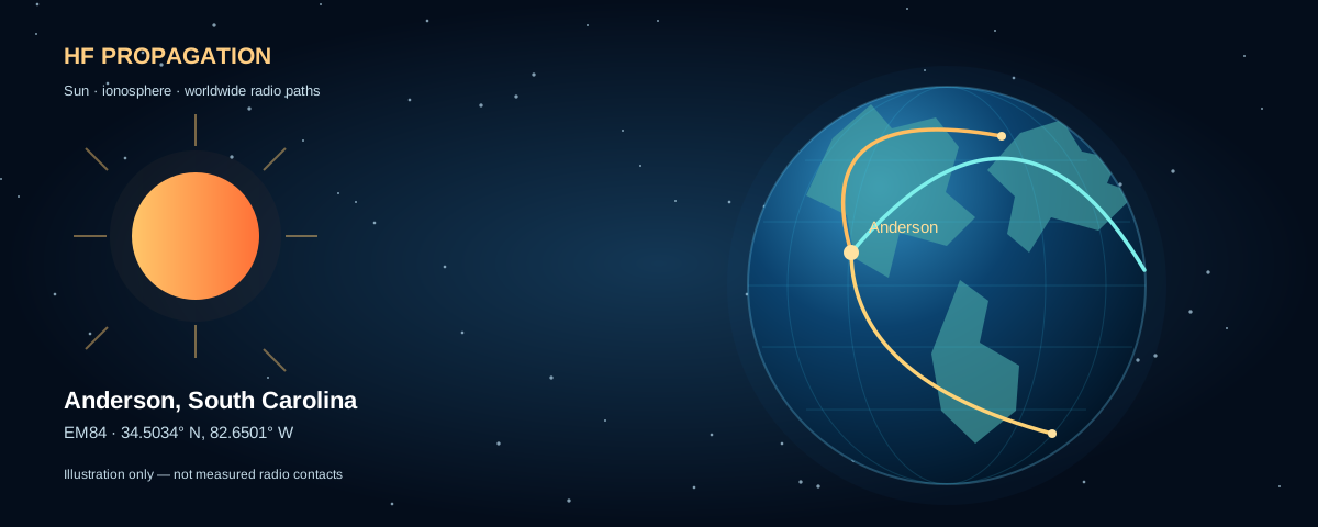
WORLDWIDE AMATEUR RADIO
Solar activity shapes the bands.
Geomagnetic storms can disrupt HF paths. Use the observed Kp index and solar flux as context—actual band conditions depend on time of day, frequency, season, and the path.
Current observations
Loading…Planetary Kp index—Loading NOAA reading…
10.7 cm solar radio flux—Solar flux units (sfu), latest NOAA report
Waiting for NOAA feeds…—
Solar wind speed—km/s · NOAA
G — geomagnetic storms—0 none; 1–5 storm scale
R — radio blackouts—0 none; 1–5 severity
S — radiation storms—0 none; 1–5 severity
Live solar indices are measured by NOAA. The illustration above is conceptual. PSK Reporter and Reverse Beacon Network provide actual reported contacts.
Kp values from 0–9 indicate geomagnetic disturbance; Kp 5+ is storm level. Solar flux alone does not produce a reliable band-by-band “good/bad” prediction. These readings are updated only when NOAA publishes new data.
WA4JWD & K4JLS · MORSE CODE
Morse Code Trainer
Learn at your own pace, six letters at a time. Choose the same lesson again on any later visit to this device.
Practice controls
AUDIO • CWPractice automatically continues through new letters or words after each answer. Use Stop practice to end your session. iPad and phone browsers require a first tap to unlock audio.
Copy what you hear
READY· — · · · —
Listen, enter your answer and press Enter or Check answer. The next challenge plays automatically 1.5 seconds later; practice continues until Stop is pressed.
Not running • Start practice when ready
Choose a lesson, then tap Start continuous practice. Each answer advances automatically after 1.5 seconds.
Correct0
Attempts0
Accuracy—
Progress for this lesson is saved on this device.
Morse reference chart
YOUR SELECTED LETTERSWA4JWD & K4JLS · RF PROPAGATION LAB
Simplex Radio Range Estimator
Model site elevation, antenna height, earth curvature, transmitter wattage and received signal strength. Compare VHF/UHF line-of-sight with HF ground wave and skywave paths.
Anderson, SC (EM84) is the reference station. Frequencies are starting presets, not band-plan operating recommendations. Always verify your license privileges and authorized frequencies.
Interactive simplex path map · pick both stations
Map opens over Anderson, South Carolina. Choose Place TX and tap the location where the operator is transmitting; then choose Place RX and tap the receiving location. Pins can be dragged to fine-tune either position. Use any two locations—not just Anderson and Fair Play.
TX · Transmitter
Not selected
RX · Receiver
Not selected
Place both markers to see terrain and suggested antenna heights.
The terrain cross-section will appear when two pins are selected and the elevation data loads.
*Suggested equal antenna height is the approximate minimum above ground level at each end for a geometric path with 60% first-Fresnel clearance along the sampled terrain. It assumes standard 4/3-Earth refraction and the obstruction allowance selected here. An elevation profile is only an approximation: 90-meter digital elevation data and sample spacing can miss trees, buildings or narrow ridges. It does not predict real-world coverage or HF skywave. Your actual antenna can be on the ground, tower, or handheld—enter its AGL height below.
Elevation: Open-Meteo / Copernicus DEM GLO-90 (90 m). Maps: © OpenStreetMap contributors. Coordinates and elevations are fetched when you pick locations; no map pins are sent to K4JLS.com servers by this feature.
Two-station radio setup
Standing handheld preset: antenna 5 ft above ground, 5 W FM, approximate −3 dBi rubber-duck gain. Power and reception estimates depend on the actual radios.
Represents receiver, noise, bandwidth and mode, not guaranteed sensitivity.
Compare signal budget with the distance you want to reach.
Ground elevation & handheld line of sight
Enter ground elevation in feet above mean sea level (MSL), not antenna height. Station antenna heights above ground are entered above. You can also select TX/RX pins on the map above to load an automatic sampled elevation profile. Manual elevations and midpoint values remain available if the terrain service cannot be reached.
Ground halfway between antennas. This is not the entire terrain profile.
For trees, buildings, or other obstacles at the midpoint.
Enter both station elevations to see their antenna heights above sea level.
The map tool samples an approximate terrain profile; manual entries below continue to provide a three-point check if the online terrain profile is unavailable. Even a sampled profile may miss narrow ridges, foliage and buildings.
HF ionospheric scenario
For skywave, takeoff angle and assumed layer height determine the hop geometry. Extra absorption is a user-chosen scenario—not a measured loss. The ionosphere may not return this frequency at all.
Estimated range · VHF/UHF line of sight
Estimated usable geometric reach—Illustrative calculation, not a coverage guarantee
Combined radio horizon—4/3-earth radio refraction assumption
Link margin at modeled range—Receiver threshold + fade margin
SWR mismatch loss—At the transmitting antenna
Power after mismatch—Before transmitter feedline loss
Change frequency, power and antenna height, then recalculate.
Site elevation / terrain checkEnter ground elevations for both locations and an optional midpoint terrain elevation.
Power needed at target distance—Select a target above.
Earth curvature & radio-wave path
DISTANCE-SCALED VIEWCurved EarthRadio pathIonosphere (HF only)
Curvature follows the calculated distance. For close VHF paths, vertical scale may be exaggerated and will be labeled.
How to interpret the model
VHF/UHF: radio-horizon range uses the standard 4/3-effective-Earth approximation and a free-space link budget. Power can be the limiting factor when it runs out before the horizon; extra power cannot remove Earth's curvature or a hill. Ground elevation above sea level is not a substitute for height above surrounding terrain. When map points and terrain loading are available, the selected path is sampled along the full route; manual entries still perform only a three-point check. Clear geometric ray and 60% first Fresnel clearance are separate engineering checks.
HF: an educational conditional skywave scenario or coarse ground-wave illustration. The link budget models power, gains, losses and hop absorption; it does not calculate MUF/LUF, D-layer conditions, receiver noise at your location, ground conductivity, solar time at each hop, or actual reliability. Accurate HF forecasting requires an ionospheric model such as ITU-R P.533 or VOACAP. Do not rely on this for emergency communications planning.
WA4JWD & K4JLS · ANTENNA DESIGN
Antenna Design & Build Planner
Choose an antenna, enter your frequency, and calculate starting dimensions, a complete parts checklist and construction steps. Save the design as a PDF.
1 · Describe the antenna
The measurements are established design formulas, not guesses from AI. When the Cloudflare AI binding is enabled, the same Calculate button also requests extra build guidance. It never silently changes the calculated dimensions.
2 · Calculated design
Total element / perimeter—Feet
Length in inches—Inches
Length in centimeters—Centimeters
Individual element—Length per leg or radial
Select an antenna and calculate a construction starting point.
3 · Parts & materials checklist
ESTIMATED QUANTITIES| Qty. | Part / material | Size / notes |
|---|---|---|
| Choose a design to calculate the parts list. | ||
Material quantities are starting estimates, not product quotations.
4 · Assembly and tuning steps
Always keep antennas and their supports well away from electric lines. Verify structural safety, proper grounding, RF exposure and SWR before transmitting.
5 · Cloudflare AI design assistant
OPTIONAL LIVE AIAI can explain trade-offs, suggest variations and describe construction. Verified formulas—not AI-generated guesses—remain the authoritative starting dimensions.
Ready. Use Calculate to request additional advice when AI is enabled.
AI suggestions must be checked against a trusted antenna design and verified with an antenna analyzer. Custom antenna types are concept-only until checked.
FCC AMATEUR CALLBOOK
Call Sign Lookup
Look up United States amateur license information with Callook.info.
The built-in lookup uses the public Callook.info service and needs internet access. For some local-file browser settings, cross-origin requests may be blocked; the “Open on Callook” button still works. U.S. licenses only.
AMATEUR RADIO REFERENCE
Popular ham bands
Common U.S. amateur bands (not a substitute for the full FCC/ARRL band plan).
| Band | Approx. U.S. allocation | Common use |
|---|---|---|
| 160 m | 1.8–2.0 MHz | Nighttime HF |
| 80 m | 3.5–4.0 MHz | Regional HF, nighttime |
| 40 m | 7.0–7.3 MHz | Regional and DX |
| 20 m | 14.0–14.35 MHz | Daytime long-distance DX |
| 17 m | 18.068–18.168 MHz | HF WARC band |
| 15 m | 21.0–21.45 MHz | Daytime DX when open |
| 12 m | 24.89–24.99 MHz | HF WARC band |
| 10 m | 28.0–29.7 MHz | DX, FM repeaters, local |
| 6 m | 50–54 MHz | Local, sporadic-E openings |
| 2 m | 144–148 MHz | FM repeaters, simplex, APRS |
| 1.25 m | 222–225 MHz | FM repeaters, simplex |
| 70 cm | 420–450 MHz | Local repeaters, satellites, digital |
Operating permissions depend on license class, emission type and sub-band. Be sure to consult current FCC Part 97 and ARRL band charts before transmitting.
Official ARRL band plans ↗LOCAL CONDITIONS
Anderson, South Carolina weather
Current weather model/observation from Open-Meteo; internet required.
☁️
—°F
Fetching latest available data…
Feels like—
Humidity—
Wind—
Cloud cover—
Source: Open-Meteo, coordinates near downtown Anderson. Values may be model-based rather than a station directly at your property.
AUTOMATIC PACKET REPORTING SYSTEM
APRS tracker & maps
Launch the real APRS.fi map for a station or the Anderson area.
LIVE STATION POSITIONS · APRS.FI
Open full live map ↗Anderson, South Carolina
Map default: 34.5034, −82.6501 · opens at area zoom 10 · real APRS.fi network data
APRS.fi may block embedded display. Use the full-map link if it appears blank; the map is served by APRS.fi.Live APRS ↗
Find a station
APRS.fi is an actual live APRS service. This page opens its map rather than inventing station locations. A station will appear only if it has transmitted and been received.
APRS notes
North America144.390 MHz
Common terrestrial APRS frequency
Packets1200 baud AFSK
Common VHF APRS packet mode
Your equipmentKenwood TH-D75A
Can use APRS with GPS and configured packet settings
TrackingCoverage varies
iGates and digipeaters affect APRS.fi visibility
QSO NOTES
Ken & Jim's radio logbook
Save contacts on this device. Export your log as CSV or ADIF.
Add a contact
Saved QSOs
0 contactsContacts are kept in this browser's local storage, not synchronized between devices. Back them up with CSV or ADIF exports. In private browsing or when browser data is cleared, saved contacts may be lost.
73 & BEST DX
About K4JLS
A family ham radio homepage, built around curiosity, learning and making contacts.
TWO CALL SIGNS · ONE HOBBY
Ken, WA4JWD · Jim, K4JLS
From Anderson, South Carolina to operators around the world, amateur radio connects friends, family, and communities—one conversation at a time.
ExploreLocal on-air resources
Anderson-area repeaters with the 50-mile radius preselected.
LearnRadio calculators
Coverage planning and practical antenna measurements.
Stay connectedContacts & APRS
QSO notes and links to real station tracking.
ARRL HAMFESTS & CONVENTIONS
Live ARRL calendar ↗East Coast hamfests
Events near Anderson and across the eastern U.S. Listings checked October 10, 2026; confirm details with ARRL or the organizer.
This is a verified, dated snapshot, not an automatic live ARRL feed. Past events are hidden automatically. Cancellations or schedule changes are possible; use the organizer/ARRL links to verify before travel.